
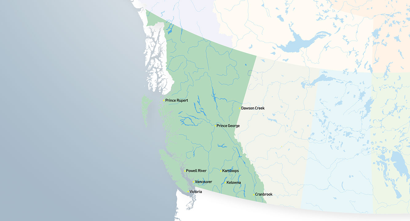

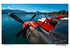
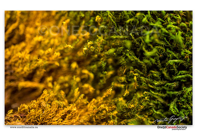
La Colombie-Britannique, qui est la troisième plus grande province et celle la plus à l’ouest du pays, offre un mélange étonnant de culture, de population et de nature. Les premiers explorateurs sont arrivés en Colombie-Britannique à la fin du 18e siècle. Cependant, elle n’a pas été officiellement créée avant le 20 juillet 1871. Le gouvernement canadien a alors promis la construction de la voie ferrée transcanadienne qui relierait la Colombie-Britannique aux autres provinces canadiennes.
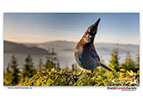
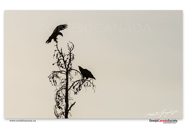
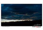
Outre le fait d’être appelée le Hollywood du Nord, la Colombie-Britannique contient plus de 27 000 km de côtes, certains des arbres les plus vieux du Canada, l’insaisissable « Spirit Bear » ainsi que certaines des plus grandes migrations de saumons au monde. La Colombie-Britannique est la seule province pouvant se vanter de son West Coast Special : ski le matin, puis golf ou bateau en après-midi.


Copyright @ 2024 Martin Gregus, One 50 Canada Society. All rights reserved. Designed by LEBO advertising
"One 50 Canada" word mark, "One 50 Canada"logo and "Thank you Canada" are trademarks of Martin Gregus
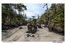
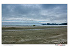
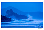
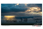
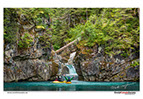
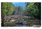
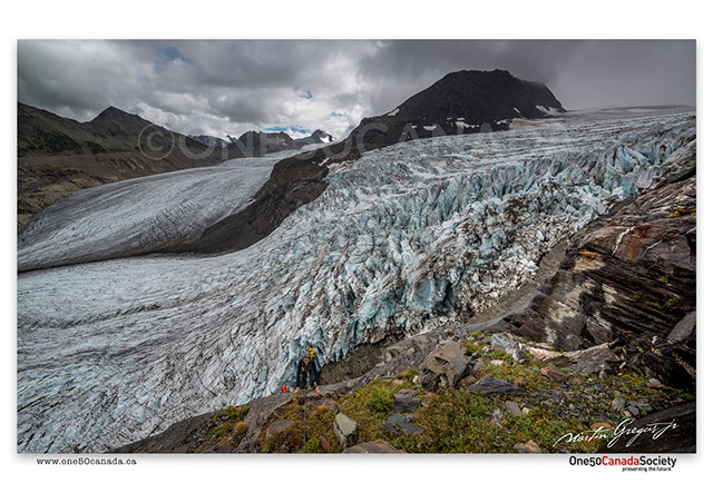
Located at the Northern tip of Vancouver Island lies Cape Scott Provincial Park; only accessible by a network of trails this is a true wilderness that isn't short on old growth forests and rugged stormy shores. A onetime exploratory visit to this park was nowhere near enough as we are still very keen on coming back to document this region's many shorelines and off shore islands during the most dangerous and most beautiful time of year.


x
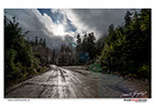


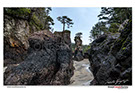
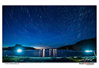
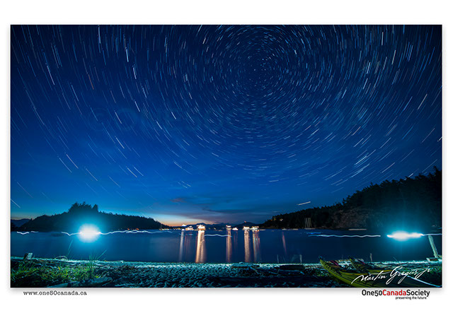
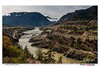
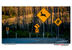
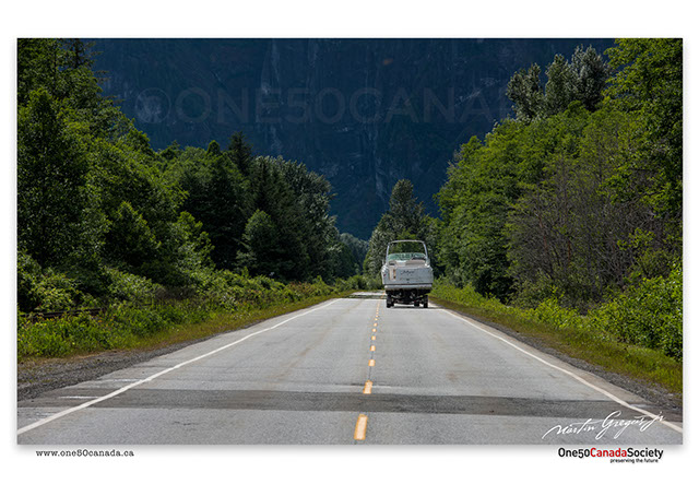
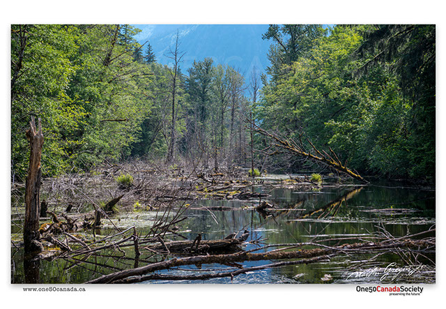
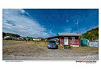
Though much of British Columbia's coastlines remain accessible only by boat or by plane a handful of paved roads on the mainland and on Vancouver Island connect Canada to the Pacific Ocean; where they end is where the adventure begins. A totally improvised trip due to a change in weather lead us to a small community of Port Alice, going further still we discovered that there is a large selection of unmarked forest roads that can take you almost anywhere as long as you're willing to go the distance.
x
x
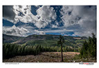
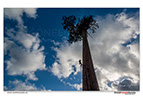
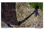
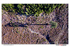


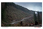
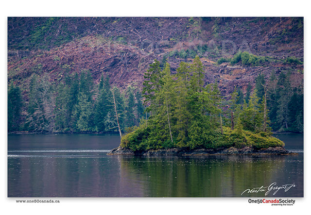
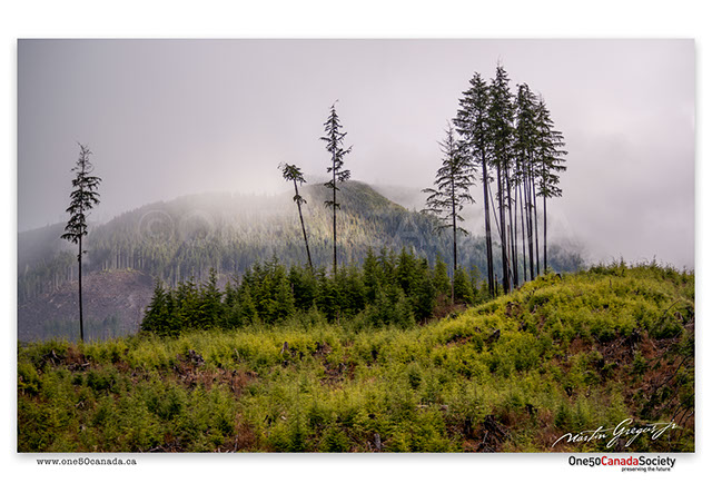
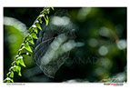
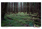
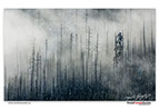
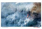
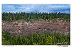
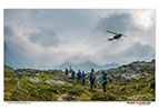
In a fast changing world documenting the Canada that we see today does not necessarily mean that this is what it will look like tomorrow. Many of the forests in British Columbia are now highly fragmented and of that even fever are old growth forests. Most people don't realize the difference until shown Canada's second largest tree standing alone in the middle of a clear cut. This is why we paired up with the Ancient Forest Alliance in order to climb it.
x
x


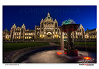


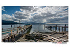
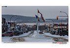
Not only is Victoria the capitol of British Columbia, but it is one of the few towns on Canada's west coast that still has the feel and history of the first European settlements, cruise ships bring thousands of tourist to the city in the summer while many windsurfers gather just outside the city every winter.
x
x
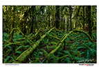

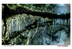


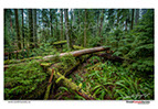


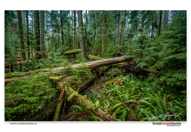
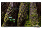
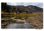
Forestry has been one of British Columbia's greatest industries since it was first colonized by European settlers. It is no wonder that it has greatly reduced the ancient forests that once covered the west coast to only a few locations. Cathedral Grove near Port Alberni is home to old growth forest that are around 800 years old, although logging has continued all the way to the parks boundary the area protected gives us a clear look into what this province once looked like.
x
x


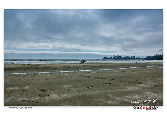


At the end of western Canada, British Columbia finally meets the Pacific Ocean and nowhere is the epic battle between land and sea more popular than at Pacific Rim National Park. Old surfing communities and a popular destination, Tofino and the surrounding areas are the true picture of what the west coast looks and feels like to all it's visitors.
x
x
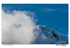
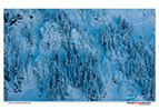


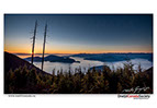
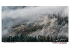
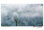
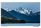
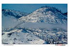
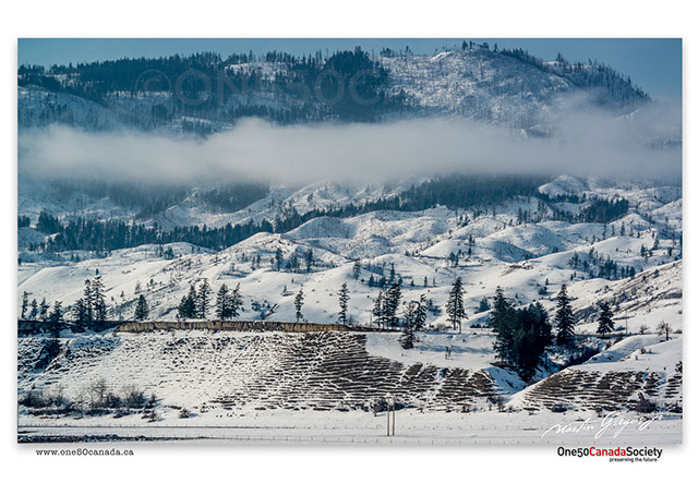
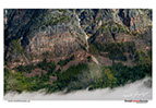
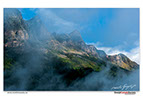
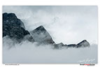
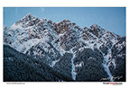
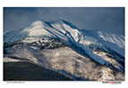
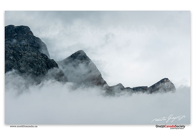
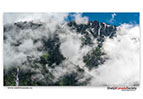
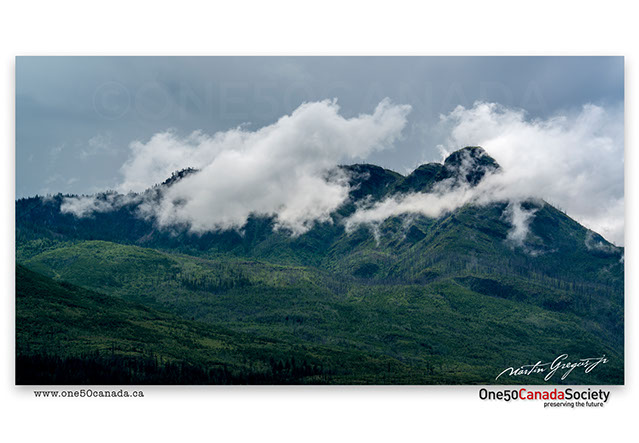
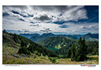
Above the stormy shores and forests that have been around for thousands of years are a surprising amount of high alpine mountains, considering that this is an island. Somehow we have the worst luck in terms of weather for this region, no wonder they call it a rainforest, but on recent trip the weather cleared and revealed a landscape blanketed by snow and fog steaming from the mountains. Come summer we can't wait to return to these mountains and photograph a group of small rodents that are only found on this one island.
x
x

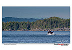
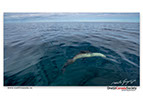
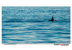
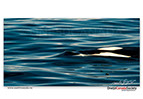
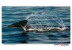


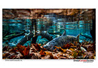
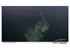
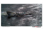
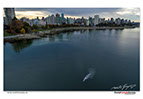
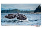
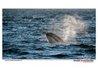
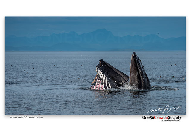
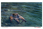
Never have we seen an ocean so flat and still only broken by the bow of our ship breaking the surface and the pod of Killer Whale's hunting for seals. Truly an amazing sight, one that we never wanted to leave as the whales waved to us and swam under the boat. This like many will remain an experience that we will never forget, however to the fisherman, whale watchers and sailors this is just another day on the ocean.
x
x


With long and rainy winters it is no wonder that come summer all the people who can escape to their summer cottages along the coast take their chance. Abandoned islands and coastal communities come to life as the days get warmer and longer, the beaches fill with people and a variety of small local festivals and celebrations take place at unnamed locations across the country.
x
x
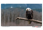


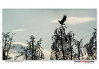
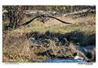
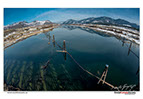
Howe Sound, also known as Vancouver's playground is home to some of the largest concentrations of recreational activities in such a close proximity to wild nature than anywhere else in the world. While people from Greater Vancouver come here to windsurf, sail, rock climb and more, thousands of eagles and salmon fill the oldgrowth forests of the Squamish Valley in what is one of the worlds great migrations.
x
x


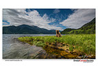
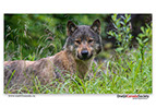
Spending two months living with the eagles and the salmon of the Chehalis River Estuary proved to be one of the wildest of our expeditions to date. The search for the perfect shot took us deep into the heart of the delta, hiking though waist deep grass and traversing a landscape of channels, it proved easier to just follow the trails created by the bears and the wolves that frequent the area. At the end of the day one couldn't believe how peaceful it can get just a few hours away from one of British Columbia's largest city.
x
x


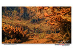
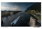
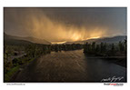
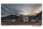
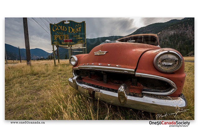
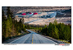
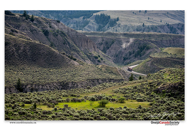
Autumn is such a beautiful and photogenic time of year, a time of change not only in weather, but also in the landscapes. Winter storms forced us out of the interiors a day early and having a whole day to kill before returning home we decided to take the longest way possible to get back. Using highway 99 from Cache Creek to Vancouver turned out the be the best decision of the weekend as not only was this area clear of rain, but there was literally something different to shoot behind every corner.
x
x
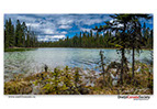
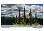
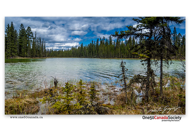


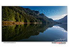
Only in Canada would you wake up one morning and decide to take the four hour detour. After a weekend of boating on the lakes near Kamloops we decided to change our scenery and head north to Moose Valley Provincial Park where we loaded our boat and set out to explore the parks many pristine lakes and tiny islands.
x
x
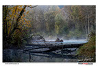
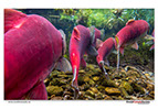
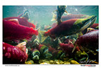
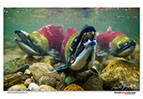
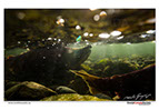
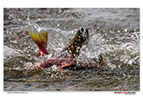

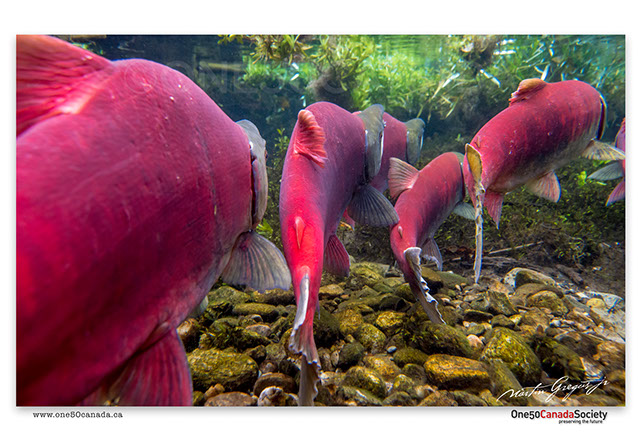


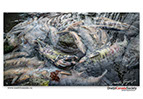
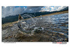
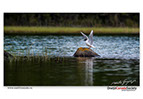
Hundreds of miles from the nearest ocean, lays one of the largest Sockeye Salmon migrations in the world. Each year millions of salmon battle the river in order to reach they’re spawning grounds up stream; with 2014 living up to being one of the dominant years at Roderick Haig-Brown Provincial Park. No one knowing exactly when the salmon will show up meant that we spent a few days over a period of one month diving with the fish in the fast flowing water, trying to get a different perspective and the perfect shot.
x
x


We like to call these trip exploratory, for us that basically means the region was to nice to capture in the time that we had. Though Sometimes the images we are looking for consist of people and cities; other times they consist of landscapes and wildlife, whatever they are we don't always find them, but we always find something that is totally unplanned. It is the unplanned that inspires us to take those long winding dirt roads to reach our destination as those hold the largest treasures and the best images and stories .
x
x
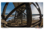


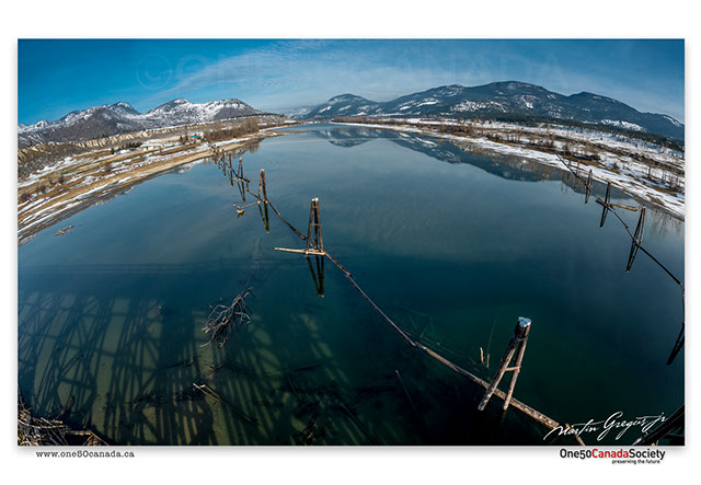


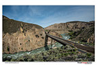
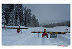
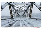
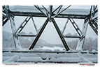
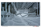
For the fact that we never actually spent a full day in the area between Kamloops and Salmon Arm, other than a trip to Roderick Haig-Brown Provincial Park we have had a great deal of luck on the road. Ranging from epic thunder storms lasting only a few minutes to hours spent in the winter sun discovering old bridges along the Thompson River, this region certainly kept us awake.
x
x
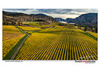
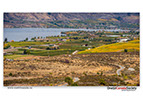


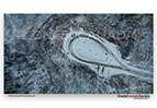
Not only is the Okanagan region well known for its vine and many fruit orchards, but it just happens that like the coast many people come here during the summer to enjoy their vacations on the water. However not all the water is suited for water sports, some have a purpose much deeper and much more spiritual like the spotted lake in the Okanagan Valley which is well known amongst the aboriginal people for its therapeutic waters.
x
x


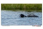
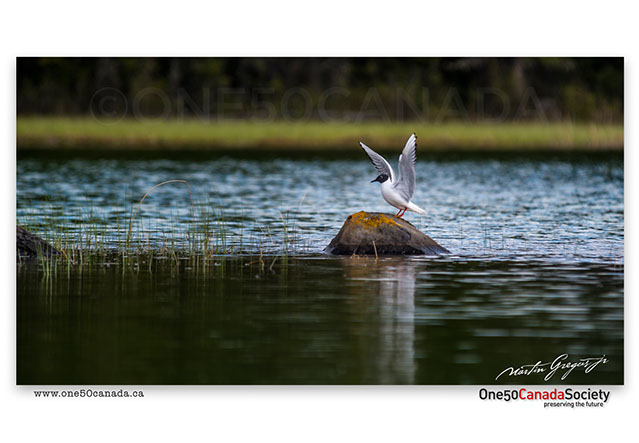
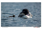
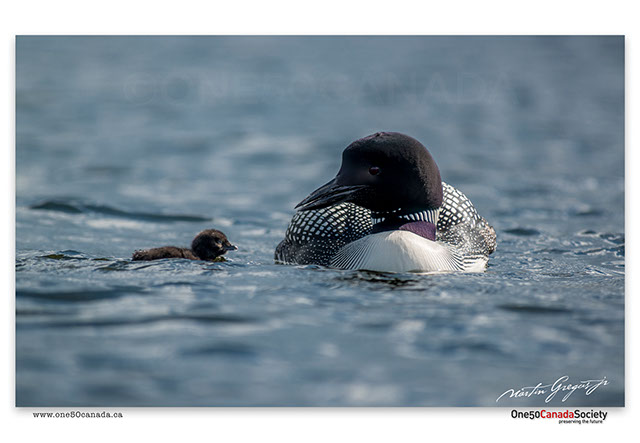
The Thank you Canada expedition and project largely consists of everything, the people, the industries and the nature. We simply plan out a trip and film/photograph everything in between, finding beauty, inspiration and excitement in the most unlikely of places. Traveling from Logan Lake to Moose Valley Provincial Park to photograph loons, we took every chance that we could to shoot the industries that we found along the way.
x
x
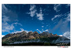


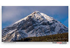
There is no better welcome to the Rockies than driving from British Columbia right towards Mt Robson, the highest mountain in the Canadian Rockies. It is rather rare to see the mountains summit not be covered by clouds, so rare in fact that out of the many times we have driven past it we have seen it from base to summit only once. Beyond the road and surrounding the mountain lies Mt Robson Provincial Park, a scenic wilderness that we hope to fully explore during our next visit.
x
x


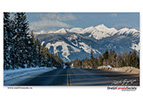


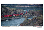
There is only a handful of roads that connect British Columbia and Alberta, traveling back and forth across the country makes these roads along with the cities and parks that they cross our most visited location. Glacier National Park, Golden and Revelstoke are only a few of the locations that we have seen through all the seasons and weather conditions because they were on the way to our final destination. It always makes us wish that we could see every place that we visit in this kind of way.
x
x


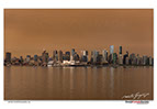


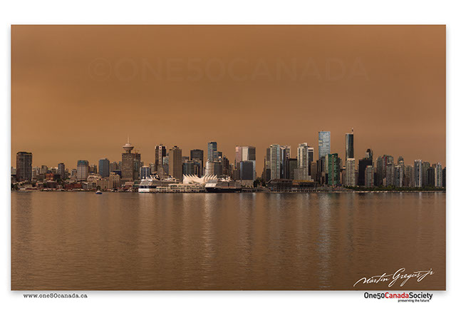


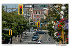
To some Vancouver might be the best place earth, while to others it might be the rainiest city in the world; nonetheless there are many different stereotypes for the Vancouverite. A very frequented tourist destination and Canada's third largest city, Vancouver was also home to the 2010 winter Olympics and to this day prides itself for it's unique mountain and ocean combination.
.jpg?crc=4242020083)
x
x
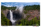
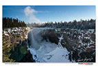
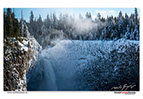
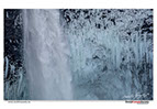


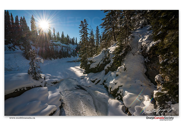

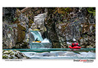
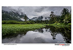
Winter or summer Wells Gray Provincial Park remains the one place that we always end up visiting. Using it only as a scenic pit stop to take a short break and have lunch while watching the parks many waterfalls; we still plan on returning to this area in the near future for more than a day to snowshoe under Helmcken Fall and photograph the ice climbers.
x
x


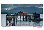
Prince Rupert - the wildest little city that Thank you Canada has visited so far. Sitting right at the edge of the Coast of British Columbia and surrounded by miles of uninhabited costliness Prince Rupert was our starting point in reaching remote British Columbia. Dominated by lush rainforest's there is much wilderness to still be explored in this inaccessible area.
x
x

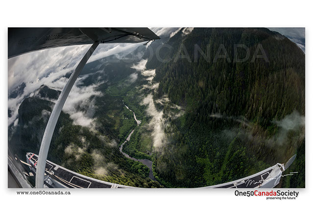
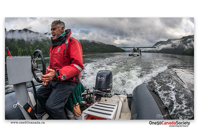


Somewhere in the middle of the glacially carved fjords, far from any civilization lies one of the most magical paradise you can imagine. A land of greens and blues dominated by Grizzlies and Wolves this one remote location is rich with opportunity a true gateway to supernatural British Columbia. Thanks to Ocean Light II Adventures the Thank you Canada team was given the opportunity of a life time to document and enjoy the Khutzeymateen Valley like never before.
x
x


A stop over for us, but home to many small and large industrial communities the road through Prince George on our way up north made for a nice stop over after 900km. The Endless scenery is dominated by forests and hills as far as the eye can see until every so often you hit the first major snow storm in February.
x
x
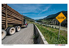


Hard to imagine that in the middle of the vast forests lies one of British Columbia's largest deserts and canyons. Though you might go all day without seeing another tourist you are constantly passed by dozens of trucks carrying logs up and down the winding roads and many switchbacks from well, no one knows where.
x
x


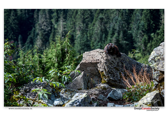


Having once roamed the high alpine peaks of Vancouver Island the Vancouver Island Marmots numbers plummeted to only about 21 wild animals in 2003, since then thanks to the help and dedication of the Marmot Recover Foundation in BC those numbers have increased to around 400 by 2013. Considered one of the world's rarest mammals these beautiful creatures are slowly recolonizing the high alpine slopes of Vancouver Island.
x
x


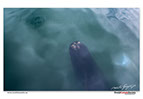
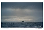
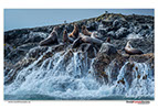
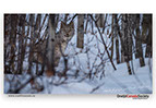
The Northern tip of Vancouver Island is a wilderness waiting to be explored; believe it or not many have tried in the past and many have failed. This is a wilderness built only for the hardy and the few, a coastline battered by the elements and home to what used to be some of the rarest animals in BC. Due to it's inaccessibility it is no wonder that these animals are just as curious to see you as you are to see them.
x
x
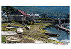


Situated on the border of a whale paradise, Alert Bay is a small isolated coastal community with many hidden cultures dating back hundreds of years. Many remnants of history still litter the island community; some stand as colourful sculptures while others like old monuments that are slowly being dismantled by the very power that brought the people here.
x
x


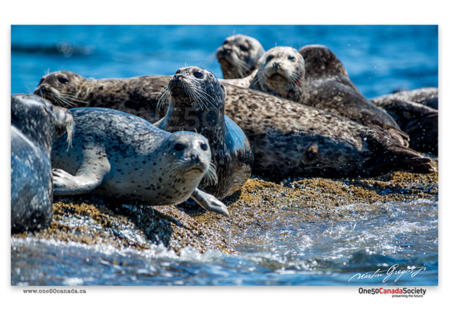
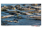
It's no wonder why these inlets are called some of the richest waters in the world, after all some of these are so filled with Dolphins, Orcas, Seals, and Humpbacks that not seeing one of those is considered rare. For anyone this area is an ocean wonderland; from the many sounds named after the mammals that call them home to the isolated islands populated by Bears, experiencing this beauty on a luxury sailboat is nothing short of a once in a lifetime dream.
x
x


Where else in the world can you ski some of the most pristine mountains in the world in the winter and traverse some of the most rugged terrain imaginable in the summer. The answer is a lot more simple than the rock climbing, zip lining, and heli hiking you will have to do to reach iconic glaciers like the Conrad and summit mountains like the Nimbus, but regardless the thrill of the CMH empire in the remote Canadian Rockies is unmatched.
x
x


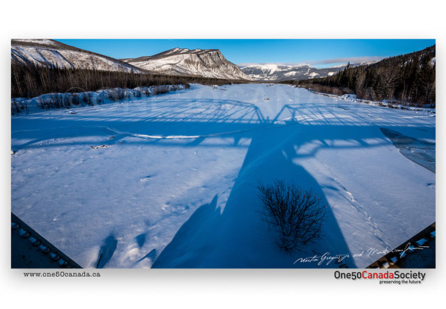
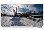
The most photographed bridge on our 8000km travels was the one that kept us locked behind it for over 24 hours; it almost even canceled our whole trip. Stuck at the heli lodge in Bell 2; we would have much rather gone skiing than sleeping in the car, but that's what you get for driving to the arctic in the winter.
x
x


A stop over for us, but home to many small and large industrial communities the road through Prince George on our way up north made for a nice stop over after 900km. The Endless scenery is dominated by forests and hills as far as the eye can see until every so often you hit a July snow storm in the mountains.
x
x


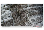
The last set of mountains as the Rockies turn into prairie can at points be very different than the Rockies further south. Though smaller, but equally as beautiful the sides of the mountains turn from cliffs into sanded down waves of rock frozen in time as the winds and ice continuously change the landscape.
x
x
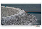


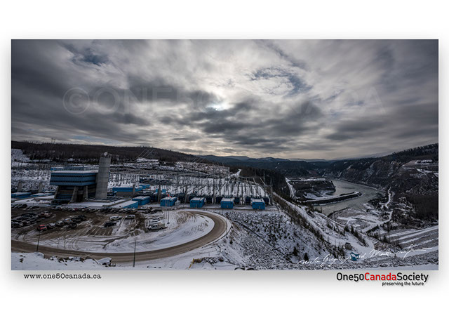


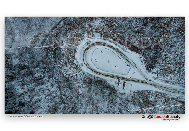

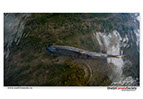
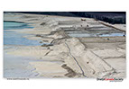
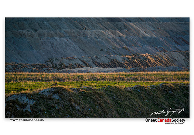
Home to some of the largest concentrations of hydro-power plants in BC the Peace River country is a fast changing landscape. In the wold that we live in today we are often shown the landscape after a dam is destroyed, but not so often do we see it before it was built. Much of the land that we traveled and photographed will be covered beneath the water in the near future as the controversial Site C Dam gets built. By the time Canada is 200 years old this Valley will most likely be a lake.
x
x


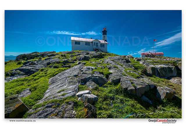


Highly inaccessible group of islands situated off the coast of Victoria was once a graveyard for oncoming ships until a lighthouse station was built. Scheduled for demolition after being decommissioned the faith of the island was uncertain until Pearson Collage took on the task of stewardship for the island and ecological reserve. Today largely due to their research and protection Race Rocks is an inaccessible paradise to the many and a school to the few.
x
x
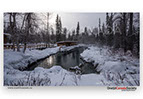


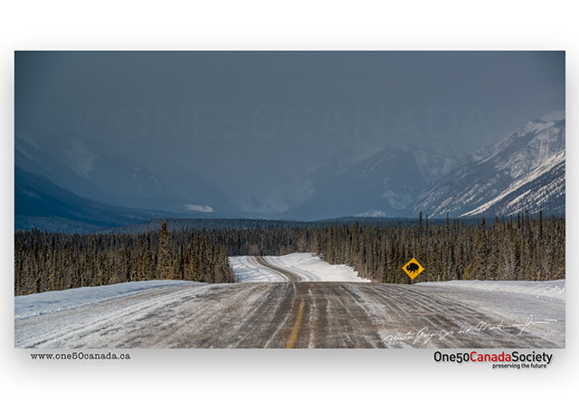

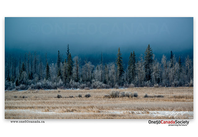
A trip of snow storms in what was likely the warmest winter it was no doubt that our trip from Watson Lake to Fort St. John would be a quick and boring ride. However that was not the case as the clouds cleared over Muncho Lake showing a beautiful winter landscape. Still not cold enough for the steam to freeze onto the plants at the Liard Hot Springs we pushed on home.
x
x


Once a remote forest in northern BC and today the start of the Alaska Highway as well as an industrial city; Dawson Creek has changed many times over the years. Having been home to many refugees fleeing Europe during World War 2, today this area is greatly different than what the Europeans must have seen in the late 1930s. Kinuseo Falls being only a small window into what it must have looked like.
x
x


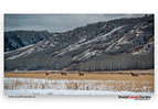
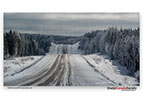
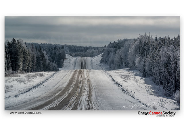
The change between the seasons makes the landscape unrecognizable other than the odd landmark here and there. Littered with only a few roads as soon as you escape the cities means traveling from a to b requires you to pass through points which you have seen many times before.
x
x
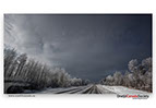
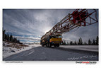
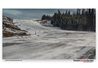
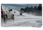
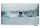
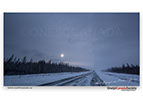


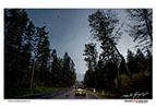
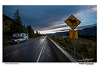
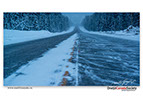
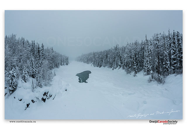
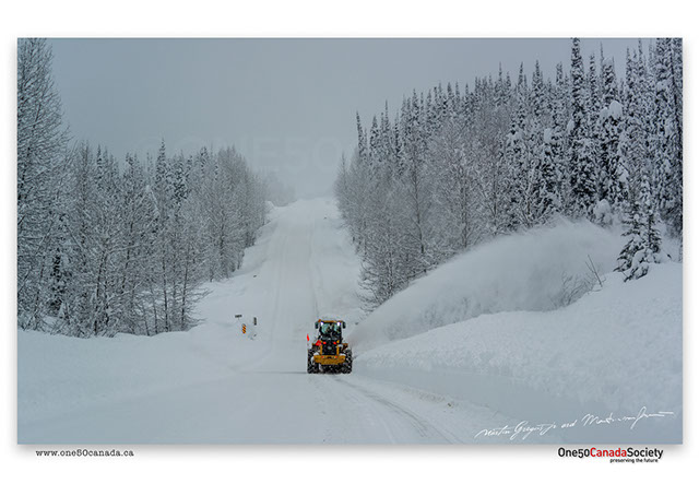
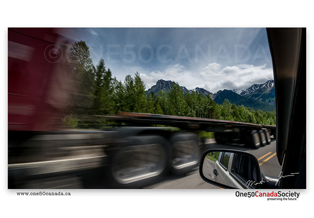
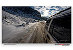
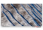
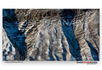
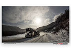
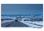
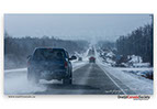
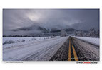
Sometimes the only thing you see all day is road though often different the road is a lot more difficult in the winter. Wanting to travel as far as possible in one day we traveled on the ice and snow covered road stopping only to photograph the snow drifts, every so often being blanketed by the semi which had passed us.
x
x